Lauwersmeer Dike and Harbor
Dike and harbor bordering Lauwersmeer National Park
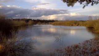
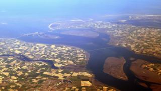
The Lauwersmeer Dike and Harbor form a striking gateway between land and water in the northern Netherlands, where the provinces of Groningen and Friesland meet. The dike itself is a key feature in the region’s landscape and history—constructed in 1969 to close off the Lauwerszee from the Wadden Sea, it transformed a saltwater inlet into the freshwater Lauwersmeer lake. This engineering feat not only protected the surrounding land from flooding but also gave rise to the unique natural environment that is now Lauwersmeer National Park.
Walking or cycling along the dike, visitors enjoy panoramic views of the vast lake on one side and the tidal flats of the Wadden Sea on the other. The harbor at Lauwersoog, situated at the northern end of the dike, is a lively spot where fishing boats, pleasure craft, and ferries come and go. Here, you can watch the bustle of maritime activity, sample fresh seafood at one of the harbor-side eateries, or catch a ferry to the nearby island of Schiermonnikoog.
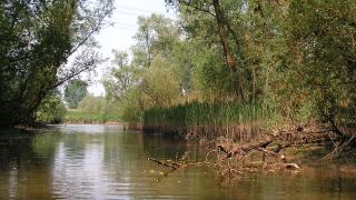
The area is popular with birdwatchers, as the dike and harbor provide excellent vantage points for spotting migratory and resident bird species. Whether you’re interested in local history, nature, or simply enjoying the open skies and water, the Lauwersmeer Dike and Harbor offer a memorable experience at the meeting point of land and sea.
Categories
More photos coming soon
Nearby Attractions
Other places to visit in Lauwersmeer


Quick Facts
Best Time to Visit
May to September offers mild weather, abundant birdlife, and ideal conditions for hiking, cycling, water sports, and stargazing at Lauwersmeer.