
- Where
- Rhenen, Utrecht
- Directions
- Directions
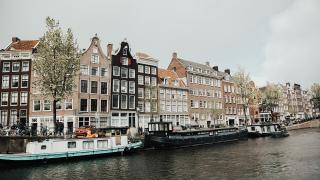
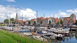
The Rhine at Rhenen is the Nederrijn, the Lower Rhine, the branch of the great river that flows westward through the middle of the Netherlands after the main stream splits at the delta. The river runs along the southern side of Rhenen, a small town in the province of Utrecht, and for centuries it shaped everything about the place: its position, its defences, its trade and its landscape. The town's very name is generally linked to the river.
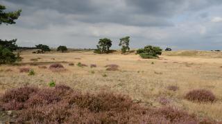
The Rhine was one of the great highways of Europe, carrying goods from the Alps to the North Sea, and the Romans used its lower course as the northern frontier of their empire. Settlements grew up wherever the river could be crossed or where a hill rose above the floodplain. Rhenen sits on the edge of the Utrechtse Heuvelrug, a ridge of low hills pushed up by ice-age glaciers, and its high ground offered both safety and a view across the valley. That combination of river and ridge makes the setting unusually varied for the Netherlands.
Today the riverbank is mainly a place for recreation. Walkers and cyclists follow the dike and floodplain paths, and the river meadows, called uiterwaarden, are grazed by cattle and horses and visited by geese and other waterbirds, especially in winter. The water is broad and slow, and passing barges still give a sense of the river's working life. Sunsets over the floodplain are a highlight for photographers.
Nearby sights add historical and family interest. The Sint Cunerakerk and its tall tower dominate the town, Ouwehands Zoo is one of the best-known zoos in the country, and the Grebbeberg War Cemetery commemorates the soldiers who died defending the Grebbe line in May 1940, when German forces broke through here at the start of the occupation. The Kwintelooyen nature reserve on the ridge above the town is another good walking area.
The riverside suits those who like quiet outdoor time. Cycle along the dike to the east or west, stop at a cafe, and allow time to see the town. Spring and autumn offer the best light, and the winter floods can be dramatic. Dike paths can be exposed, so a windproof layer is wise. The Utrechtse Heuvelrug National Park begins just behind the town. In the Middle Ages the Rhine linked Rhenen with the wider world, and the Church of Saint Cunera, a Gothic-style landmark, recalls that wealth. A Dutch river like this is best known by walking beside it. Strolling along the river is free, and Rhenen’s centre is close. The Rhine’s level changes with the seasons, and the River Rhine is at its most dramatic in winter.
Categories
More photos coming soon
Nearby Attractions
Other places to visit in Rhenen

Grebbeberg War Cemetery
WWII battlefield cemetery honoring Dutch defenders
History & Heritage · Cemeteries

Kwintelooyen
Nature reserve with ancient trails and hilltop views
Activities & Adventure · Natural Wonders

Ouwehands Zoo
Home to the Netherlands’ only giant panda enclosure
Family Activities · Zoos & Aquariums
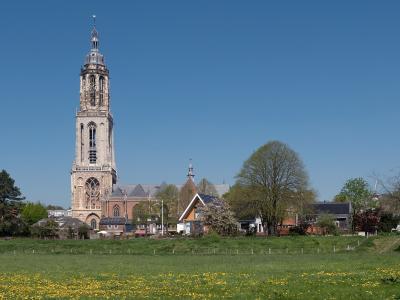
Sint Cunerakerk
Late Gothic church with historic stained glass
History & Heritage · Historic Churches
Questions people ask
Quick Facts
Best Time to Visit
Mid-July to mid-August offers warm weather, long days, and ideal conditions for hiking, zoo visits, and exploring Rhenen’s river and hilltop scenery.